Ever wonder why there is a “lake” behind Shoney’s?
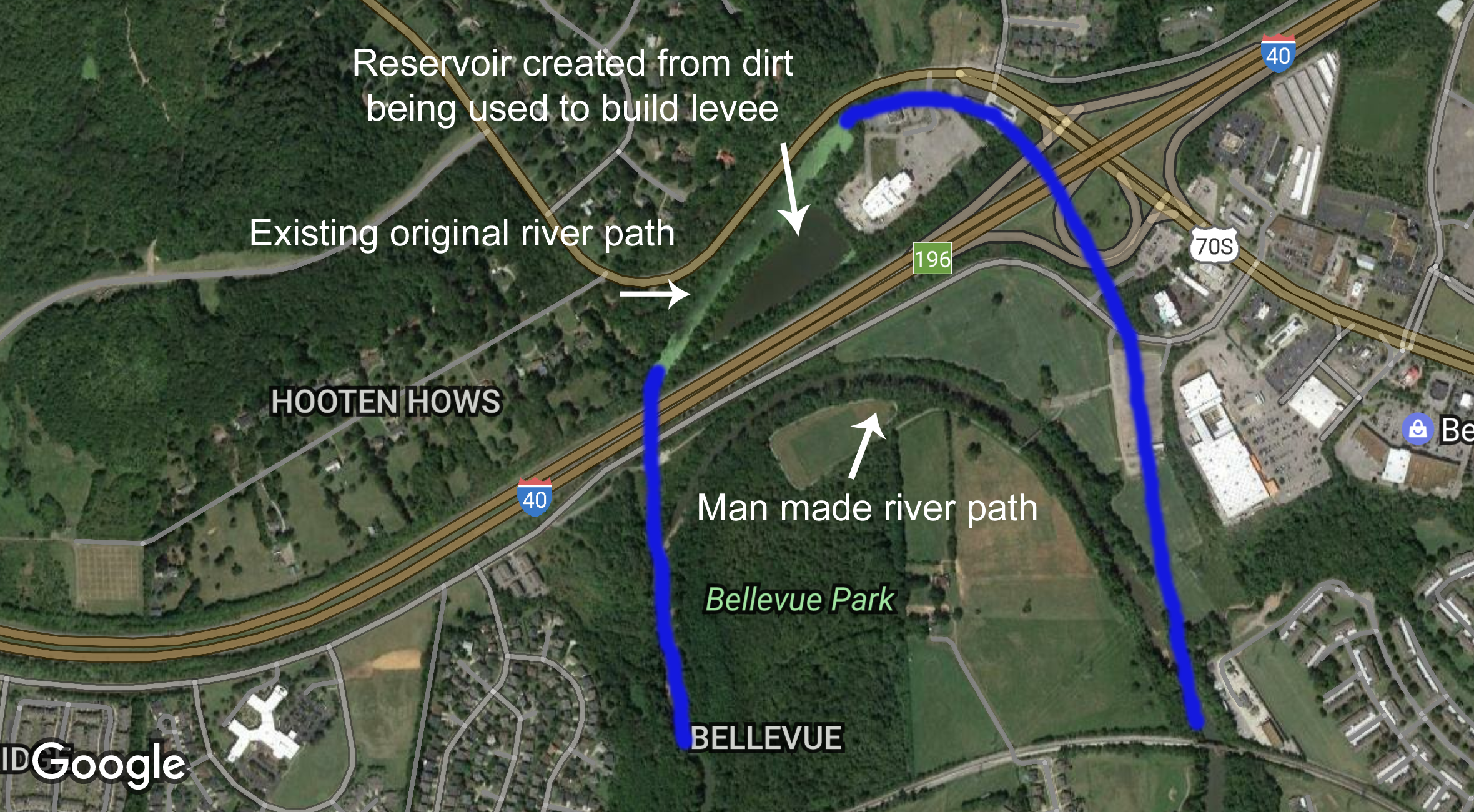
Have you ever wondered why there is a small body of water behind the Shoney’s in Bellevue? In the late 1960’s, when I-40 was built, the Harpeth River was actually re-routed. The diversion was created to save the expense of building two additional bridges for I-40. The body of water that runs next to Highway 70S (between Hooten Hows Road & Shoney’s) was the original river channel. The large triangle section of water closer to the interstate is a small reservoir that was created when the land was used to build the I-40 levee and to back-fill portions of the original river bed. In the first photo below, it’s our best estimate as to where the original river flowed on the east side of I-40. We based our guess on the 1930 hand-drawn map below. It is possible that it was slightly more to the west.
(Click on the picture for a larger version)
Below is a map from 1930 (From Tennessee State Library and Archives) showing the original river path before I-40 was built.


